JMA conducted aircraft-based upper-air observation from February 2011 to March 2024 with support from Japan's Ministry of Defense to clarify three-dimensional distribution of greenhouse gases (GHGs) and related species.
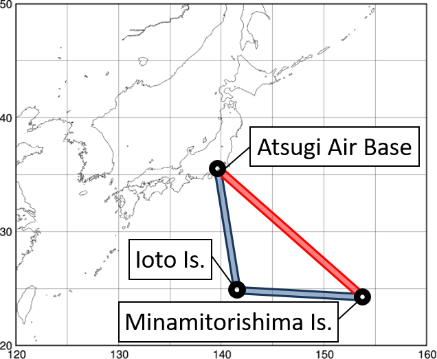
![]() The figure below displays results from observation over the northwest Pacific. The monitoring was conducted in single directions on monthly round trips between Atsugi Air Base and Minamitorishima Island. The aircraft routes are displayed by the red line (non-stop) and the blue lines (via Ioto Island) in the panel on the right. The latter route brings a large volume of data for the area around 25°N in particular.
The figure below displays results from observation over the northwest Pacific. The monitoring was conducted in single directions on monthly round trips between Atsugi Air Base and Minamitorishima Island. The aircraft routes are displayed by the red line (non-stop) and the blue lines (via Ioto Island) in the panel on the right. The latter route brings a large volume of data for the area around 25°N in particular.
Click a tab below to see observation results.