Updated on 1 Dec. 2025
Japan Meteorological Agency
Gridded data for carbon dioxide partial pressure (pCO2), sea-air CO2 flux, pH, dissolved inorganic carbon(DIC) and total alkalinity(TA) are available for download.


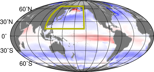
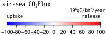
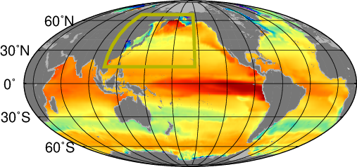
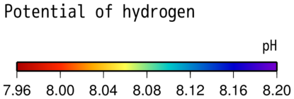
The boxes indicate the area covered by regional datasets, and distribution maps are based on global datasets. Grids with NA values are covered using data from regional datasets where available.
The JMA Ocean CO2 Map dataset contains information on global oceans and the western North Pacific. It includes data on monthly oceanic inorganic carbonate variables (such as pCO2, pH, DIC, TA and sea-air CO2 flux) over a 1° latitude × 1° longitude grid (global) and a 0.25° latitude × 0.25° longitude grid (regional). The DIC and TA fields were calculated using analytical sea surface temperatures, salinity and chlorophyll-a concentration data from satellite observation, and the other variables were derived from these two parameters. Sea-air CO2 flux components were calculated from differences between oceanic and atmospheric pCO2 and maritime wind speeds. Details of global database creation were provided by Iida et al. (2021), and production of a paper on regional database creation is currently in progress.
Data are in NetCDF format (ZIPped) with the dimensions and variables shown below.
dimensions:
        lon = 360 ;
        lat = 180 ;
        time = 12 ;
variables:
        float lon(lon) ;
                lon:units = "degrees_east(0.5_359.5)" ;
                lon:_FillValue = -999.f ;
                lon:long_name = "longitude" ;
                lon:point_spacing = "even" ;
        float lat(lat) ;
                lat:units = "degrees_north(-89.5_89.5)" ;
                lat:_FillValue = -999.f ;
                lat:long_name = "latitude" ;
                lat:point_spacing = "even" ;
        int time(time) ;
                time:units = "months since 2011-01-15" ;
                time:long_name = "time" ;
        float pCO2s(time, lat, lon) ;
                pCO2s:units = "uatm" ;
                pCO2s:_FillValue = -999.f ;
                pCO2s:long_name = "sea surface pCO2" ;
        float flux(time, lat, lon) ;
                flux:units = "mol/m2/yr" ;
                flux:_FillValue = -999.f ;
                flux:long_name = "sea-air CO2 flux positive:source for atmosphere" ;
        float dic(time, lat, lon) ;
                dic:units = "umol/kg" ;
                dic:_FillValue = -999.f ;
                dic:long_name = "DIC" ;
        float ndic(time, lat, lon) ;
                ndic:units = "umol/kg" ;
                ndic:_FillValue = -999.f ;
                ndic:long_name = "Salinity normalized DIC" ;
        float ta(time, lat, lon) ;
                ta:units = "umol/kg" ;
                ta:_FillValue = -999.f ;
                ta:long_name = "Total Alkalinity" ;
        float nta(time, lat, lon) ;
                nta:units = "umol/kg" ;
                nta:_FillValue = -999.f ;
                nta:long_name = "Salinity normalized TA" ;
        float pH(time, lat, lon) ;
                pH:units = "pH" ;
                pH:_FillValue = -999.f ;
                pH:long_name = "total scale pH in insitu SST" ;
dimensions:
    lon = 400 ;
    lat = 208 ;
    time = 12 ;
variables:
    float lon(lon) ;
        lon:units = "degrees_east(105_205)" ;
        lon:_FillValue = -999.f ;
        lon:long_name = "longitude" ;
        lon:point_spacing = "even" ;
    float lat(lat) ;
        lat:units = "degrees_north(15_67)" ;
        lat:_FillValue = -999.f ;
        lat:long_name = "latitude" ;
        lat:point_spacing = "even" ;
    int time(time) ;
        time:units = "months since 2024-01-15" ;
        time:long_name = "time" ;
    float ndic(time, lat, lon) ;
        ndic:units = "umol/kg" ;
        ndic:_FillValue = -999.f ;
        ndic:long_name = "DIC normalized to salinity 35" ;
    float dic(time, lat, lon) ;
        dic:units = "umol/kg" ;
        dic:_FillValue = -999.f ;
        dic:long_name = "Dissolved Inorganic Carbon" ;
    float nta(time, lat, lon) ;
        nta:units = "umol/kg" ;
        nta:_FillValue = -999.f ;
        nta:long_name = "TA normalized to salinity 35" ;
    float ta(time, lat, lon) ;
        ta:units = "umol/kg" ;
        ta:_FillValue = -999.f ;
        ta:long_name = "Total Alkalinity" ;
    float pCO2s(time, lat, lon) ;
        pCO2s:units = "uatm" ;
        pCO2s:_FillValue = -999.f ;
        pCO2s:long_name = "sea surface partial pressure of CO2" ;
    float pH(time, lat, lon) ;
        pH:_FillValue = -999.f ;
        pH:long_name = "pH in situ temperature" ;
    float oa(time, lat, lon) ;
        oa:_FillValue = -999.f ;
        oa:long_name = "Aragonite saturation state" ;
    float flux(time, lat, lon) ;
        flux:units = "mol/m2/yr" ;
        flux:_FillValue = -999.f ;
        flux:long_name = "sea-air CO2 flux positive:source for atmosphere" ;
    float gcss(time, lat, lon) ;
        gcss:units = "mol/m2/yr/uatm" ;
        gcss:_FillValue = -999.f ;
        gcss:long_name = "gas exchange coefficient" ;
    float pCO2spsd(time, lat, lon) ;
        pCO2spsd:units = "uatm" ;
        pCO2spsd:_FillValue = -999.f ;
        pCO2spsd:long_name = "prediction interval of pCO2s 1 sigma" ;
}
JMA_co2map_sample.ZIP - a sample R source file program enabling data reading (137°E, 30°N) for specific years and months (ZIPped).
Monthly oceanic CO2 data are archived every year. All files are within 12 MB. The latest dataset should be used, as flux data are recalculated with every update.
JMA_co2map_v2024 JMA_co2map_nwpac_v2024
The following citations should be included to cite the global datasets:
Production of a paper on regional database creation is currently in progress.