Himawari-8/9 Spacecraft Overview
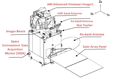
Each of Himawari-8/9 carries a new unit called the Advanced Himawari Imager (AHI). The table below lists the major specifications of Himawari-8/9.
New frequency bands are introduced for communication between the satellites and ground stations. The Ka-band is used for downlinking meteorological data, and the Ku-band is used for telemetry and command operations. Each satellite carries a transponder to relay environmental data from data collection platforms (DCPs) to sustain the data collection system (DCS).
| Geostationary position | 140.7° E |
| Attitude control | 3-axis attitude-controlled geostationary satellite |
| Imaging sensor | Advanced Himawari Imager (AHI) |
| Communications | 1) Raw observation data transmission
|
2) DCS
|
|
3) Telemetry and command
| |
| Prime Contractor | Mitsubishi Electric Corporation |
| Launch vehicle | H-IIA rocket |