 GTSPP Data Product CentreGTSPP Data Product Centre
GTSPP Data Product Centre for the North Pacific Region hosted by the Japan Meteorological Agency
MAERSK LOME(V7GQ8), PX05
Observation period : 2018/10/13 to 2018/10/22
Observation period : 2018/10/13 to 2018/10/22
Reference figures
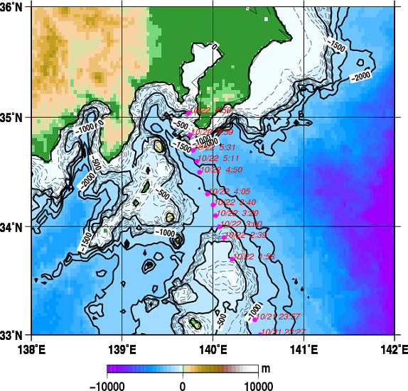
| ◊Observing stations and ocean topography (etopo2) Red circles and letters denote observing stations and date respectively and the date format is MM/DD hh:mm (where MM: month, DD: day, hh: hour, mm: minute). Solid contour interval is 500 m from the depth of 0 m to 2000 m and broken contour interval is 100 m from the depth of 0 m to 1000 m. |
 |
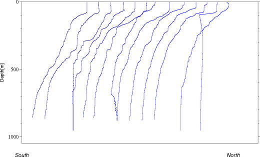
| ◊Vertical temperature profile Vertical profile of temperature corresponding to the above station map moved the entire profile by 5 degree Celsius. |
 |