
Climate Report over Japan
Monthly Highlights
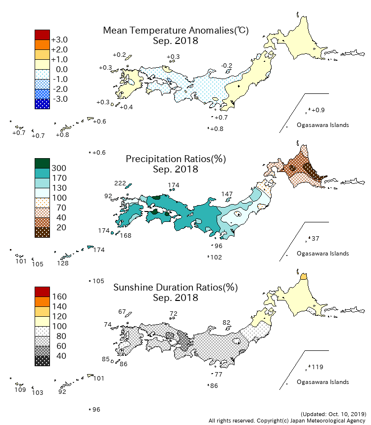
In eastern and western Japan, monthly sunshine durations were significantly below normal because the rain front tended to stay over the regions, which brought cloudy and rainy weather there. Monthly precipitation amounts in the regions were significantly above normal as the humid air often flowed towards the rain front from the enhanced high pressure system to the south of Japan. In addition, two typhoons (JEBI (T1821) and TRAMI (T1824)) also contributed to the above normal precipitation, which made landfall in the country and brought heavy rain, wind storm and storm surge nationwide.
Climate Anomaly Table Over Japan
Monthly Climate Anomaly over Japan
Time Series of Temperature Anomaly

Time Series of 10days Precipitation Amount Ratio and Sunshine Duration Ratio

10-day Mean Sea Level Pressure


10-day Mean 850hPa Temperature


10-day Mean 500hPa GeoPotential Height


10-day Mean Outgoing Longwave Radiation


Note: Figures of outgoing longwave radiation (OLR) in Monthly Report over Japan are based on the NOAA CPC Blended OLR data from the September 2023 report, while they were based on the NOAA CPC AVHRR OLR data until the August 2023 report.