
Climate Report over Japan
Monthly Highlights
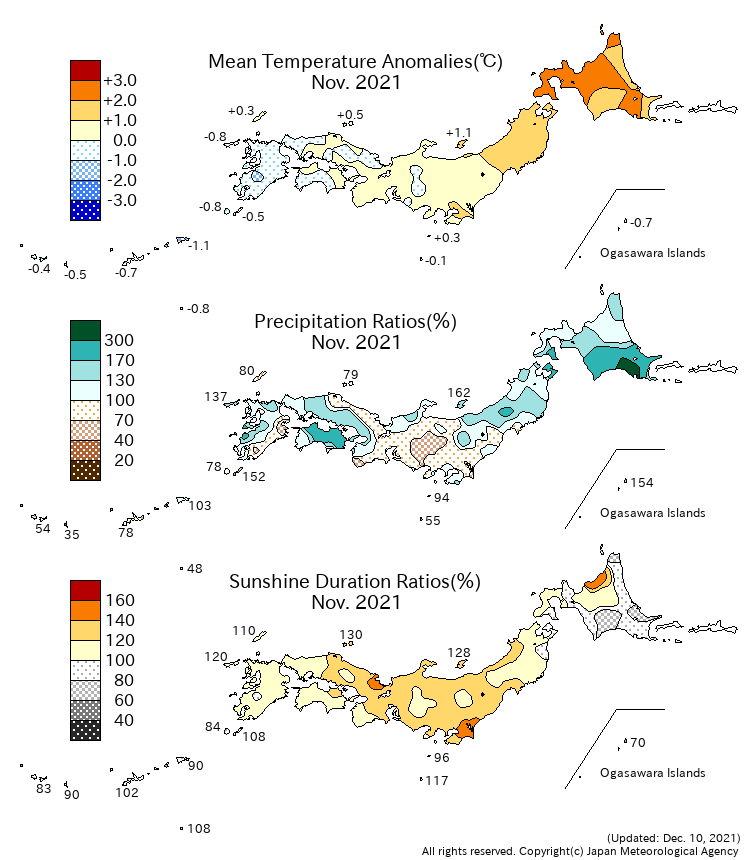
- Monthly mean temperature was significantly above normal in northern Japan due to weaker cold air inflow and repeated warm air advection in front of cut off lows. On the other hand, it was below normal in Okinawa/Amami due to stronger than normal cold air inflow.
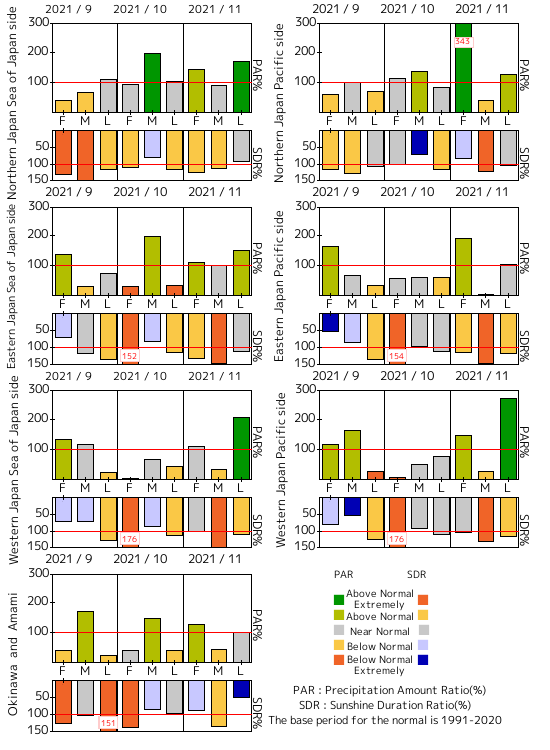
- Monthly precipitation amounts were above normal in northern Japan and on the Sea of Japan side of eastern Japan due to influences from the cut off lows, and on the Pacific side of western Japan due to a low pressure system that passed on end of the month.
- Monthly sunshine durations were significantly above normal in eastern Japan, and above normal in western Japan, because anti-cyclones frequently covered these regions mainly in the middle of the month. The duration was also above normal on the Sea of Japan side of northern Japan.
Climate Anomaly Table Over Japan
Monthly Climate Anomaly over Japan
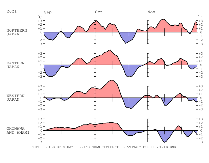
Time Series of Temperature Anomaly
Time Series of 10days Precipitation Amount Ratio and Sunshine Duration Ratio
10-day Mean Sea Level Pressure


10-day Mean 850hPa Temperature


10-day Mean 500hPa GeoPotential Height


10-day Mean Outgoing Longwave Radiation


Note: Figures of outgoing longwave radiation (OLR) in Monthly Report over Japan are based on the NOAA CPC Blended OLR data from the September 2023 report, while they were based on the NOAA CPC AVHRR OLR data until the August 2023 report.