
Climate Report over Japan
Monthly Highlights
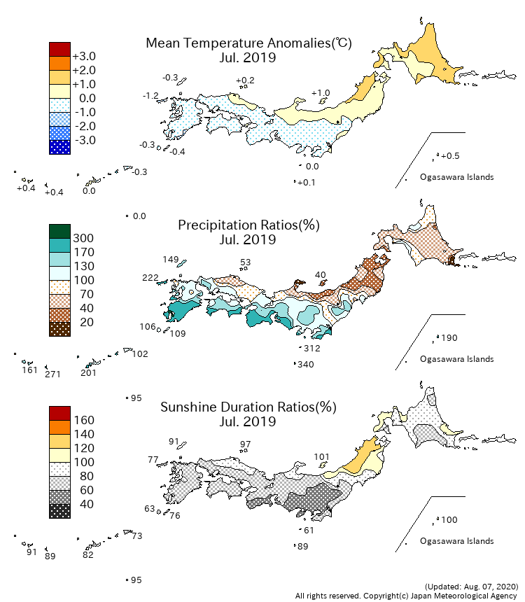
From the beginning of the month to the first half of the last ten days, cloudy and rainy days were dominant all over Japan, due to the Baiu front and the Okhotsk High. In addition, due to the effects of Tropical Storm DANAS (T1905) and NARI (T1906), monthly precipitation amounts were significantly above normal on the Pacific side of eastern and western Japan. Around the end of the month, sunny and hot days were dominant nationwide since the North Pacific Subtropical High increased its strength and enlarged its area to the main island of Japan .
Climate Anomaly Table Over Japan
Monthly Climate Anomaly over Japan
Time Series of Temperature Anomaly

Time Series of 10days Precipitation Amount Ratio and Sunshine Duration Ratio

10-day Mean Sea Level Pressure


10-day Mean 850hPa Temperature


10-day Mean 500hPa GeoPotential Height


10-day Mean Outgoing Longwave Radiation


Note: Figures of outgoing longwave radiation (OLR) in Monthly Report over Japan are based on the NOAA CPC Blended OLR data from the September 2023 report, while they were based on the NOAA CPC AVHRR OLR data until the August 2023 report.