World Climate
JMA monitors the global climate with CLIMAT and SYNOP reports provided by NMHSs via the WMO Global Telecommunication System (GTS). As part of this work, quality-checked data on temperature and precipitation are gathered to support the assessment of extreme climate events. Weekly, monthly, seasonal and annual monitoring reports on such phenomena, along with brief descriptions of disastrous events and distribution maps for temperature and precipitation worldwide, are provided on this page. The ClimatView tool enables viewing and downloading of monthly world climate data, giving users access to statistics including monthly mean temperatures, monthly total precipitation amounts and Standardized Precipitation Index (SPI).
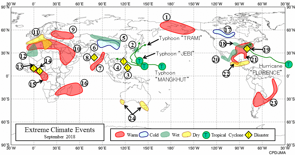
Monthly Report on Extreme Climate Events
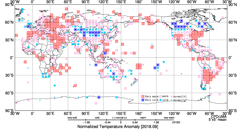
Monthly Normalized Temperature Anomaly
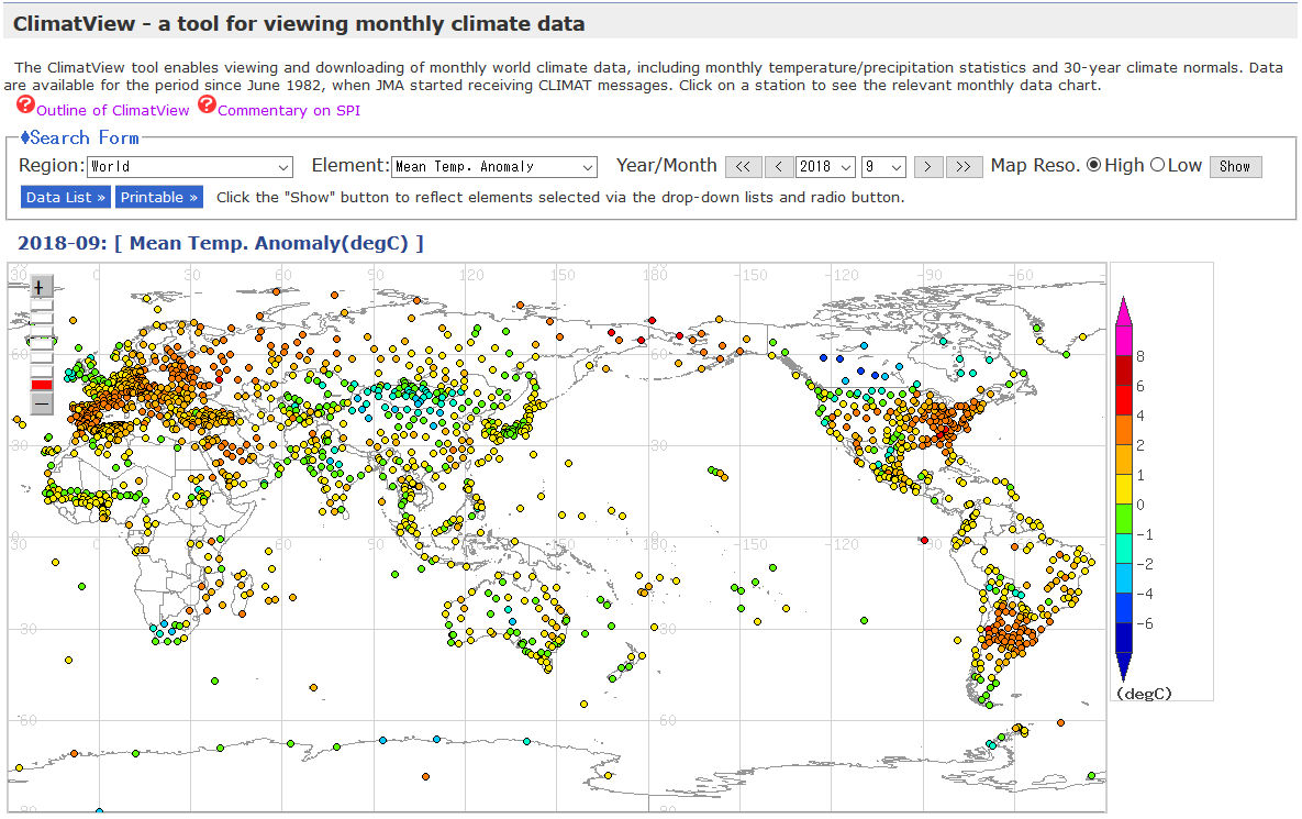
Distribution map of ClimatView
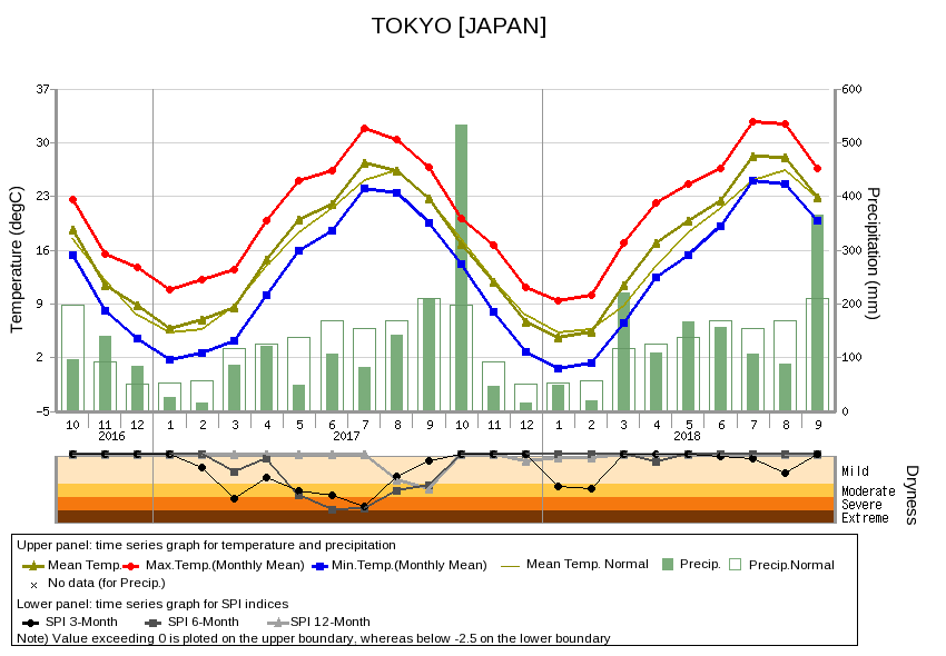
Historical graphs and data lists for individual stations of ClimatView
Prev [Provision of climate data, information and tools]
< World Climate
> Next [Climate System Monitoring]